Discover 3D primary surveillance radar and its adaptability to the most demanding locations


Over the last few years we have witnessed how the areas surrounding airports have changed due to the growth of cities, emerging new energy sources and other elements, affecting the different surveillance systems giving service to the ATM system.
Primary surveillance radar (PSR), as non-cooperative systems are being strongly affected by such environmental changes. The main primary radar currently used for civil aviation are based on systems using a passive parabolic reflector antenna, normally with two wide beams in elevation. The two beams used (low beam and high beam) are customisable to adapt the system to the environment, selecting high beam in close range to avoid clutter interference and lower beam in larger ranges. These two beams help mitigate close clutter but the elevation difference between both beams and the beams’ shape — usually with a square cosecant diagram in elevation — is not enough to completely differentiate between target and clutter, which means targets and clutter are detected together. This issue has led to the evolution of a set of different techniques to correctly discriminate target and clutter during detection process. Another important factor during the set-up of a primary radar is the antenna tilt adjustment. The elevation of the antenna boresight, or maximum gain point, must be configured according to the conditions of the location where the radar will be installed, the environment and the targeted type of traffic to be detected. In traditional primary radars with a passive parabolic reflector, the tilt is adjusted mechanically and it is homogenous for the 360° of the coverage, which means that it is necessary to determine the correct tilt value to enable complete coverage.
All these limitations are the result of the technology used traditionally for those systems. The question is — can these obstacles be overcome to improve performance? The answer is yes. Active antenna primary radar have been used for military purposes for many years. The antenna diagrams and the operational concept is different with these systems and ensures the best possible performance in the most challenging environments. In the military field, primary 3D radar has been used mainly for its capabilities to report the altitude of non-cooperative aircraft. This feature is not relevant in the civil air traffic control management, where separation services are given with information collected from other cooperative sensors, which provide more precise altitude information. However, the inherent capabilities for clutter reduction and adaptability to the environment are indeed a powerful tool to improve surveillance service.
3D primary radar, using an active antenna, explore the coverage volume with a mechanical azimuth scanning, and with an independently programmable pencil beams electronically steered in elevation. These beams are the antenna patterns with narrow lobes in both planes (azimuth and elevation) and both are used for transmission and reception. They provide a high antenna gain with low side lobe levels. This kind of exploration based on narrow beams offers inherent protection against both clutter and interferences. Target detection is clearly more feasible with pencil beam exploration than with conventional 2D because the influence of clutter is minimised. Surface clutter in the form of terrain and sea clutter affects lower elevation beams severely. Volumetric clutter, weather, typically affects the two lowest beams. High elevation beams are not significantly affected by surface or volume clutter, and therefore in this way the detection of high elevation targets is appreciably improved. With this technology, the adverse clutter effects are in the lower elevation pencil beams, where previous techniques developed for 2D primary radars are still useful. The main advantage of the 3D is that higher elevation beams are not affected by the surrounding clutter, which means the aircraft detected by high elevation beams is not masked in clutter, and detection capabilities are improved, including accuracy of the position reported. Additionally, active antenna array systems allow improved azimuth accuracy in the detections; this technology makes possible the implementation of well-known techniques, widely used in other sensors, such as azimuth monopulse, which enhances the azimuth accuracy in the target detection.
Military crossover
Both 2D and 3D primary systems include a weather channel reporting ASTERIX information in Category 008, in accordance with reflectivity levels established by ICAO and US NWS (US National Weather Service). By using the elevation information obtained, the maximum altitude of the weather perturbation is estimated. This information is very helpful for controllers when making decisions on traffic route diversion in case of bad weather conditions.
Additionally, the flexible configuration of 3D systems improves the adaptability to harsh environments. As an example, pointing of the different beams can be electronically controlled, which allows a sectorial configuration in azimuth of the beam tilt, having the possibility to set-up different tilts in different azimuth sectors, achieving a better adaptation to the geographical characteristics of the environment and the type of traffic to be detected.
In the recent years, many countries are experiencing an increase in the number of wind farms, which are usually located very close to airports, since these locations offer the perfect conditions for for this kind of electricity generation — an activity which is likely to keep expanding. The clutter generated by wind farms is especially hazardous to primary radar performance, leading manufacturers to develop advance mitigation techniques to tackle the coexistence of wind farms and a safe air traffic control service. Most techniques used are based on spatial cancellation of the echoes being returned by the windmills without affecting the detection of the aircraft. Those techniques are strongly influenced by the use of PSR antenna diagram.
All in all, the use of 3D systems is a great improvement on previous 2D systems. On the one hand, the previously mentioned inherent clutter capability, where targets and clutter coming from wind farms are detected in different beams, especially in close ranges where wind farms are more hazardous and the elevation difference between target and wind farms is higher. On the other hand, the use of the same spatial cancellation technique used in 2D radar can be implemented in 3D radar, benefiting from much better cancellation results obtained by the pencil beams antenna patterns used in 3D radar.
Weather reporting
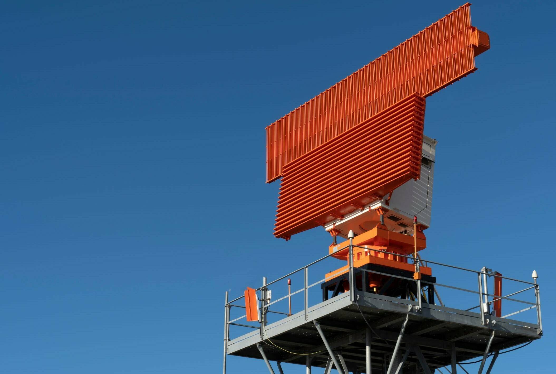
It is clear that 3D systems previously used mainly in military environments have the potential to improve the quality of the civil surveillance system. Indra has broad experience with 3D systems, we have been supplying them from the early 80’s to different government defense organisations, including NATO. The vision of Indra with respect to primary radar is to adapt these systems to the civil market, including the specific civil requirements, and obtain a system which improves previous primary performance focusing in a competitive ratio cost vs., benefits of the system. One of the main points is the adaptation of the system to a modern and advanced control and monitoring system. This has been adapted to meet civil requirements and includes the necessary features to facilitate the operation and the maintenance of the systems. Combined with the powerful BITE (Built In Test Equipment) incorporated in the radar, optimising the life cost cycle of the product. Indra’s PSR 3D L-Band solution represents the highest technological evolution in a radar system for the civil air traffic surveillance domain. It is a new radar concept for civil market specifically designed for approach and en-route surveillance purposes.
Based on Electronically Scanned Array technology, the system also embeds the latest capacities in signal generation, demodulation and processing providing three-dimensional position of the targets (height, range and azimuth). It also incorporates an integrated redundant weather channel compliant with ICAO and National Weather Services, which includes fully integrated with modern human machine interface and graphical configuration and adaptation engineering tool, and ensures the operator a complete access to every parameter and notification of the system for unattended systems working 24 hours a day, 365 days a year.
Indra’s experience
Discover 3D primary surveillance radar and its adaptability to the most demanding locations
Primary surveillance radar (PSR), as non-cooperative systems are being strongly affected by such environmental changes. The main primary radar currently used for civil aviation are based on systems using a passive parabolic reflector antenna, normally with two wide beams in elevation. The two beams used (low beam and high beam) are customisable to adapt the system to the environment, selecting high beam in close range to avoid clutter interference and lower beam in larger ranges. These two beams help mitigate close clutter but the elevation difference between both beams and the beams’ shape — usually with a square cosecant diagram in elevation — is not enough to completely differentiate between target and clutter, which means targets and clutter are detected together. This issue has led to the evolution of a set of different techniques to correctly discriminate target and clutter during detection process. Another important factor during the set-up of a primary radar is the antenna tilt adjustment. The elevation of the antenna boresight, or maximum gain point, must be configured according to the conditions of the location where the radar will be installed, the environment and the targeted type of traffic to be detected. In traditional primary radars with a passive parabolic reflector, the tilt is adjusted mechanically and it is homogenous for the 360° of the coverage, which means that it is necessary to determine the correct tilt value to enable complete coverage.
All these limitations are the result of the technology used traditionally for those systems. The question is — can these obstacles be overcome to improve performance? The answer is yes. Active antenna primary radar have been used for military purposes for many years. The antenna diagrams and the operational concept is different with these systems and ensures the best possible performance in the most challenging environments. In the military field, primary 3D radar has been used mainly for its capabilities to report the altitude of non-cooperative aircraft. This feature is not relevant in the civil air traffic control management, where separation services are given with information collected from other cooperative sensors, which provide more precise altitude information. However, the inherent capabilities for clutter reduction and adaptability to the environment are indeed a powerful tool to improve surveillance service.
3D primary radar, using an active antenna, explore the coverage volume with a mechanical azimuth scanning, and with an independently programmable pencil beams electronically steered in elevation. These beams are the antenna patterns with narrow lobes in both planes (azimuth and elevation) and both are used for transmission and reception. They provide a high antenna gain with low side lobe levels. This kind of exploration based on narrow beams offers inherent protection against both clutter and interferences. Target detection is clearly more feasible with pencil beam exploration than with conventional 2D because the influence of clutter is minimised. Surface clutter in the form of terrain and sea clutter affects lower elevation beams severely. Volumetric clutter, weather, typically affects the two lowest beams. High elevation beams are not significantly affected by surface or volume clutter, and therefore in this way the detection of high elevation targets is appreciably improved. With this technology, the adverse clutter effects are in the lower elevation pencil beams, where previous techniques developed for 2D primary radars are still useful. The main advantage of the 3D is that higher elevation beams are not affected by the surrounding clutter, which means the aircraft detected by high elevation beams is not masked in clutter, and detection capabilities are improved, including accuracy of the position reported. Additionally, active antenna array systems allow improved azimuth accuracy in the detections; this technology makes possible the implementation of well-known techniques, widely used in other sensors, such as azimuth monopulse, which enhances the azimuth accuracy in the target detection.
Military crossover
Both 2D and 3D primary systems include a weather channel reporting ASTERIX information in Category 008, in accordance with reflectivity levels established by ICAO and US NWS (US National Weather Service). By using the elevation information obtained, the maximum altitude of the weather perturbation is estimated. This information is very helpful for controllers when making decisions on traffic route diversion in case of bad weather conditions.
Additionally, the flexible configuration of 3D systems improves the adaptability to harsh environments. As an example, pointing of the different beams can be electronically controlled, which allows a sectorial configuration in azimuth of the beam tilt, having the possibility to set-up different tilts in different azimuth sectors, achieving a better adaptation to the geographical characteristics of the environment and the type of traffic to be detected.
In the recent years, many countries are experiencing an increase in the number of wind farms, which are usually located very close to airports, since these locations offer the perfect conditions for for this kind of electricity generation — an activity which is likely to keep expanding. The clutter generated by wind farms is especially hazardous to primary radar performance, leading manufacturers to develop advance mitigation techniques to tackle the coexistence of wind farms and a safe air traffic control service. Most techniques used are based on spatial cancellation of the echoes being returned by the windmills without affecting the detection of the aircraft. Those techniques are strongly influenced by the use of PSR antenna diagram.
All in all, the use of 3D systems is a great improvement on previous 2D systems. On the one hand, the previously mentioned inherent clutter capability, where targets and clutter coming from wind farms are detected in different beams, especially in close ranges where wind farms are more hazardous and the elevation difference between target and wind farms is higher. On the other hand, the use of the same spatial cancellation technique used in 2D radar can be implemented in 3D radar, benefiting from much better cancellation results obtained by the pencil beams antenna patterns used in 3D radar.
Weather reporting
Over the last few years we have witnessed how the areas surrounding airports have changed due to the growth of cities, emerging new energy sources and other elements, affecting the different surveillance systems giving service to the ATM system.
It is clear that 3D systems previously used mainly in military environments have the potential to improve the quality of the civil surveillance system. Indra has broad experience with 3D systems, we have been supplying them from the early 80’s to different government defense organisations, including NATO. The vision of Indra with respect to primary radar is to adapt these systems to the civil market, including the specific civil requirements, and obtain a system which improves previous primary performance focusing in a competitive ratio cost vs., benefits of the system. One of the main points is the adaptation of the system to a modern and advanced control and monitoring system. This has been adapted to meet civil requirements and includes the necessary features to facilitate the operation and the maintenance of the systems. Combined with the powerful BITE (Built In Test Equipment) incorporated in the radar, optimising the life cost cycle of the product. Indra’s PSR 3D L-Band solution represents the highest technological evolution in a radar system for the civil air traffic surveillance domain. It is a new radar concept for civil market specifically designed for approach and en-route surveillance purposes.
Based on Electronically Scanned Array technology, the system also embeds the latest capacities in signal generation, demodulation and processing providing three-dimensional position of the targets (height, range and azimuth). It also incorporates an integrated redundant weather channel compliant with ICAO and National Weather Services, which includes fully integrated with modern human machine interface and graphical configuration and adaptation engineering tool, and ensures the operator a complete access to every parameter and notification of the system for unattended systems working 24 hours a day, 365 days a year.
Indra’s experience